 vesseltracker.com
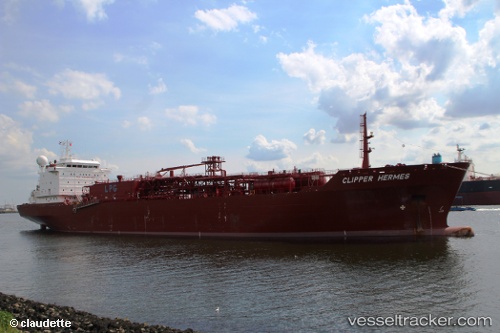
Vessel Clipper Hermes IMO: 9378151, MMSI: 258645000 Lpg Tanker
UTC, 38.97561, -39.93072, course: 238, speed: 13.3
UTC, 38.71196, -40.67692, course: -1, speed: 14
2026-03-24 19:21:40 UTC, 38.59907, -41.03018, course: 247, speed: 13.8
Live Vessel Clipper Hermes Analytics (details, animations, etc.)
Live AIS position: UTC. 108 nm S of Chapineria), updated 2026-03-24 19:21:40 UTC.Find the position of the vessel Clipper Hermes on the map. The latter are known coordinates and path.
marine traffic ship tracker show on live map
The current position of vessel Clipper Hermes is 38.59907 lat / -41.03018 lng. Updated: 2026-03-24 19:21:40 UTCCurrently sailing under the flag of Norway
Clipper Hermes built in 2008 year
Deadweight:
18880 tDetails:
Last coordinates of the vessel:
UTC, 39.07842, -39.62015, course: 244, speed: 13.8UTC, 38.97561, -39.93072, course: 238, speed: 13.3
UTC, 38.71196, -40.67692, course: -1, speed: 14
2026-03-24 19:21:40 UTC, 38.59907, -41.03018, course: 247, speed: 13.8