 vesseltracker.com
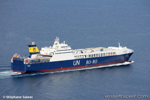
Vessel Gallipoli Seaways IMO: 9215476, MMSI: 271000623 Ro Ro Cargo Ship
UTC, 36.51901, 22.13096, course: 300, speed: 16.4
UTC, 36.66500, 21.77667, course: -1, speed: 16
2026-02-18 14:03:37 UTC, 37.21747, 21.39129, course: 334, speed: 16.5
Live AIS position:
UTC. 10 nm NW of Filiatrá),
updated 2026-02-18 14:03:37 UTC.
Find the position of the vessel Gallipoli Seaways on the map. The latter are known coordinates and path.
marine traffic ship tracker show on live map
The current position of vessel Gallipoli Seaways is 37.21747 lat / 21.39129 lng. Updated: 2026-02-18 14:03:37 UTCCurrently sailing under the flag of Turkey
Gallipoli Seaways built in 2001 year
Deadweight:
9830 tDetails:
Last coordinates of the vessel:
UTC, 36.40365, 22.71767, course: 267, speed: 17.3UTC, 36.51901, 22.13096, course: 300, speed: 16.4
UTC, 36.66500, 21.77667, course: -1, speed: 16
2026-02-18 14:03:37 UTC, 37.21747, 21.39129, course: 334, speed: 16.5