 vesseltracker.com
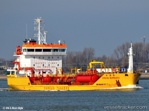
Vessel Varkan Marmara IMO: 9458145, MMSI: 271002685 Chemical Tanker
UTC, 54.37067, 10.17017, course: 207, speed: 0.2
UTC, 54.36567, 10.14100, course: 283, speed: 0.1
2026-01-18 14:12:45 UTC, 54.36067, 10.05883, course: 254, speed: 0.3
Live AIS position:
UTC. Near Altwittenbek),
updated 2026-01-18 14:12:45 UTC.
Find the position of the vessel Varkan Marmara on the map. The latter are known coordinates and path.
marine traffic ship tracker show on live map
The current position of vessel Varkan Marmara is 54.36067 lat / 10.05883 lng. Updated: 2026-01-18 14:12:45 UTCCurrently sailing under the flag of Turkey
Varkan Marmara built in 2009 year
Deadweight:
4865 tDetails:
Last coordinates of the vessel:
UTC, 54.37200, 10.17150, course: 216, speed: 0.3UTC, 54.37067, 10.17017, course: 207, speed: 0.2
UTC, 54.36567, 10.14100, course: 283, speed: 0.1
2026-01-18 14:12:45 UTC, 54.36067, 10.05883, course: 254, speed: 0.3