 vesseltracker.com
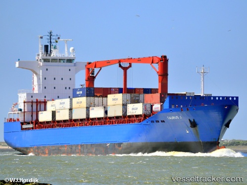
Vessel Mehmet Kahveci A IMO: 9248916, MMSI: 271044302 Container Ship
UTC, 43.99924, 37.42088, course: -1, speed: 1.7
UTC, 44.05341, 37.46418, course: -1, speed: 2.2
2026-02-25 15:40:58 UTC, 44.07077, 37.50934, course: -1, speed: 1.6
Live AIS position:
UTC. 36 nm S of Cpc Terminal),
updated 2026-02-25 15:40:58 UTC.
Find the position of the vessel Mehmet Kahveci A on the map. The latter are known coordinates and path.
marine traffic ship tracker show on live map
The current position of vessel Mehmet Kahveci A is 44.07077 lat / 37.50934 lng. Updated: 2026-02-25 15:40:58 UTCCurrently sailing under the flag of Turkey
Mehmet Kahveci A built in 2002 year
Deadweight:
18832 tDetails:
Last coordinates of the vessel:
UTC, 44.17645, 37.20241, course: 146, speed: 10.8UTC, 43.99924, 37.42088, course: -1, speed: 1.7
UTC, 44.05341, 37.46418, course: -1, speed: 2.2
2026-02-25 15:40:58 UTC, 44.07077, 37.50934, course: -1, speed: 1.6