 vesseltracker.com
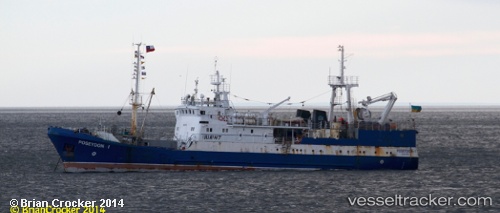
Vessel Marigolds IMO: 9447110, MMSI: 272762000 Fishing Vessel
UTC, -70.59905, -97.07116, course: 91, speed: 1.2
UTC, -70.58586, -97.06527, course: 57, speed: 0.5
2026-02-27 01:24:51 UTC, -70.56056, -96.47389, course: 88, speed: 6.7
Live AIS position:
UTC. Open sea (no nearby ports in database)),
updated 2026-02-27 01:24:51 UTC.
Find the position of the vessel Marigolds on the map. The latter are known coordinates and path.
marine traffic ship tracker show on live map
The current position of vessel Marigolds is -70.56056 lat / -96.47389 lng. Updated: 2026-02-27 01:24:51 UTCDetails:
Last coordinates of the vessel:
UTC, -70.61624, -97.16071, course: 67, speed: 1UTC, -70.59905, -97.07116, course: 91, speed: 1.2
UTC, -70.58586, -97.06527, course: 57, speed: 0.5
2026-02-27 01:24:51 UTC, -70.56056, -96.47389, course: 88, speed: 6.7