 vesseltracker.com
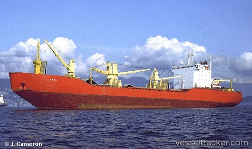
Vessel Bratsk IMO: 8888070, MMSI: 273310010 General Cargo Ship
UTC, 44.79947, 37.82957, course: 109, speed: 2.8
UTC, 44.79947, 37.82957, course: 109, speed: 2.8
2026-03-25 01:13:32 UTC, 44.72049, 37.77795, course: 109, speed: 50.3
Live Vessel Bratsk Analytics (details, animations, etc.)
Live AIS position: UTC. Near Novorossiysk), updated 2026-03-25 01:13:32 UTC.Find the position of the vessel Bratsk on the map. The latter are known coordinates and path.
marine traffic ship tracker show on live map
The current position of vessel Bratsk is 44.72049 lat / 37.77795 lng. Updated: 2026-03-25 01:13:32 UTCDetails:
Last coordinates of the vessel:
UTC, 44.79947, 37.82957, course: 109, speed: 2.8UTC, 44.79947, 37.82957, course: 109, speed: 2.8
UTC, 44.79947, 37.82957, course: 109, speed: 2.8
2026-03-25 01:13:32 UTC, 44.72049, 37.77795, course: 109, speed: 50.3