 vesseltracker.com
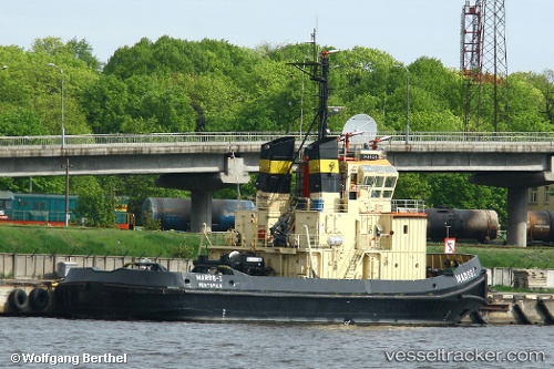
Vessel Sarmat IMO: 8027133, MMSI: 273325230 Tug
UTC, 44.60329, 37.82637, course: -1, speed: 59.6
UTC, 44.81762, 37.85939, course: -1, speed: 57.8
2026-03-02 20:04:34 UTC, 44.81762, 37.85939, course: -1, speed: 57.8
Live AIS position:
UTC. Near Novorossiysk),
updated 2026-03-02 20:04:34 UTC.
Find the position of the vessel Sarmat on the map. The latter are known coordinates and path.
marine traffic ship tracker show on live map
The current position of vessel Sarmat is 44.81762 lat / 37.85939 lng. Updated: 2026-03-02 20:04:34 UTCCurrently sailing under the flag of Russia
Sarmat built in 1982 year
Deadweight:
290 tDetails:
Last coordinates of the vessel:
UTC, 44.62301, 37.95822, course: -1, speed: 6UTC, 44.60329, 37.82637, course: -1, speed: 59.6
UTC, 44.81762, 37.85939, course: -1, speed: 57.8
2026-03-02 20:04:34 UTC, 44.81762, 37.85939, course: -1, speed: 57.8