 vesseltracker.com
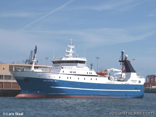
Vessel BARENTSBURG IMO: 9256676, MMSI: 273433630 Fish Carrier
UTC, 75.91661, 38.62245, course: 122, speed: 2.9
UTC, 75.85816, 39.00767, course: 132, speed: 4.8
2026-02-26 07:26:00 UTC, 75.84998, 39.07014, course: 318, speed: 4.9
Live AIS position:
UTC. 203 nm E of Hopen),
updated 2026-02-26 07:26:00 UTC.
Find the position of the vessel BARENTSBURG on the map. The latter are known coordinates and path.
marine traffic ship tracker show on live map
The current position of vessel BARENTSBURG is 75.84998 lat / 39.07014 lng. Updated: 2026-02-26 07:26:00 UTCCurrently sailing under the flag of Russia
BARENTSBURG built in 2002 year
Deadweight:
1570 tDetails:
Last coordinates of the vessel:
UTC, 76.10103, 38.27958, course: 170, speed: 4.7UTC, 75.91661, 38.62245, course: 122, speed: 2.9
UTC, 75.85816, 39.00767, course: 132, speed: 4.8
2026-02-26 07:26:00 UTC, 75.84998, 39.07014, course: 318, speed: 4.9