 vesseltracker.com
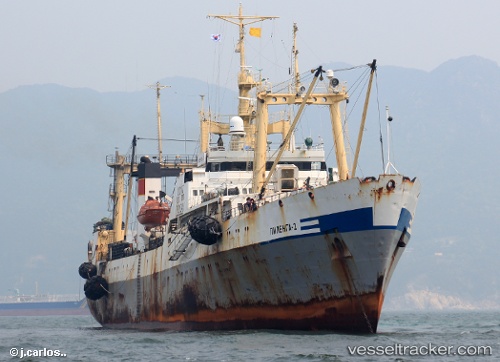
Vessel Pilenga 2 IMO: 9120310, MMSI: 273896300 Fishing Vessel
UTC, 35.05295, 129.00008, course: -1, speed: 0
UTC, 35.05295, 129.00008, course: -1, speed: 0
2026-02-10 17:25:52 UTC, 35.05293, 129.00005, course: -1, speed: 0
Live AIS position:
UTC. Near Gamcheon/Busan),
updated 2026-02-10 17:25:52 UTC.
Find the position of the vessel Pilenga 2 on the map. The latter are known coordinates and path.
marine traffic ship tracker show on live map
The current position of vessel Pilenga 2 is 35.05293 lat / 129.00005 lng. Updated: 2026-02-10 17:25:52 UTCCurrently sailing under the flag of Russia
Pilenga 2 built in 1995 year
Deadweight:
1810 tDetails:
Last coordinates of the vessel:
UTC, 35.05292, 129.00003, course: -1, speed: 0UTC, 35.05295, 129.00008, course: -1, speed: 0
UTC, 35.05295, 129.00008, course: -1, speed: 0
2026-02-10 17:25:52 UTC, 35.05293, 129.00005, course: -1, speed: 0