 vesseltracker.com
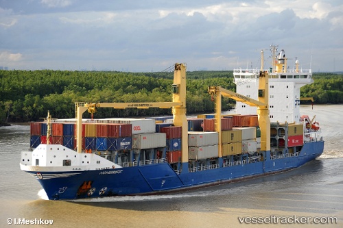
Vessel '275508000' IMO: 9366225, MMSI: 275508000
UTC, 17.87793, -76.80002, course: 97, speed: 0.6
UTC, 17.87839, -76.79983, course: 131, speed: 0.5
2026-01-18 19:33:04 UTC, 17.87812, -76.80004, course: 114, speed: 0.2
Live AIS position:
UTC. Near Port Royal),
updated 2026-01-18 19:33:04 UTC.
Find the position of the vessel '275508000' on the map. The latter are known coordinates and path.
marine traffic ship tracker show on live map
The current position of vessel '275508000' is 17.87812 lat / -76.80004 lng. Updated: 2026-01-18 19:33:04 UTCDetails:
Last coordinates of the vessel:
UTC, 17.87802, -76.80002, course: 119, speed: 0.4UTC, 17.87793, -76.80002, course: 97, speed: 0.6
UTC, 17.87839, -76.79983, course: 131, speed: 0.5
2026-01-18 19:33:04 UTC, 17.87812, -76.80004, course: 114, speed: 0.2