 vesseltracker.com
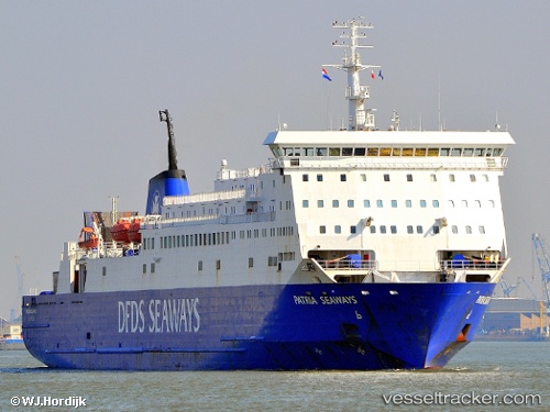
Vessel Patria Seaways IMO: 8917390, MMSI: 277291000 Passenger Ro Ro Cargo Ship
UTC, 54.24314, 11.46866, course: 237, speed: 17.8
UTC, 53.94740, 10.85908, course: 166, speed: 0
2026-02-27 21:27:22 UTC, 53.94740, 10.85908, course: 166, speed: 0
Live AIS position:
UTC. Near Travemunde),
updated 2026-02-27 21:27:22 UTC.
Find the position of the vessel Patria Seaways on the map. The latter are known coordinates and path.
marine traffic ship tracker show on live map
The current position of vessel Patria Seaways is 53.94740 lat / 10.85908 lng. Updated: 2026-02-27 21:27:22 UTCCurrently sailing under the flag of Lithuania
Patria Seaways built in 1991 year
Deadweight:
4758 tDetails:
Last coordinates of the vessel:
UTC, 54.41588, 11.96022, course: 235, speed: 16.8UTC, 54.24314, 11.46866, course: 237, speed: 17.8
UTC, 53.94740, 10.85908, course: 166, speed: 0
2026-02-27 21:27:22 UTC, 53.94740, 10.85908, course: 166, speed: 0