 vesseltracker.com
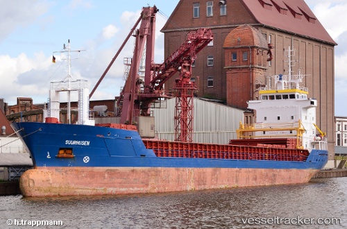
Vessel SUURHUSEN S IMO: 9123245, MMSI: 304369000 General Cargo Ship
UTC, 50.34532, -4.63266, course: -1, speed: 0.1
UTC, 50.34529, -4.63267, course: -1, speed: 0.1
2026-02-28 17:39:09 UTC, 50.34529, -4.63267, course: -1, speed: 0.1
Live AIS position:
UTC. Near Saint Sampson (Golant)),
updated 2026-02-28 17:39:09 UTC.
Find the position of the vessel SUURHUSEN S on the map. The latter are known coordinates and path.
marine traffic ship tracker show on live map
The current position of vessel SUURHUSEN S is 50.34529 lat / -4.63267 lng. Updated: 2026-02-28 17:39:09 UTCCurrently sailing under the flag of Antigua and Barbuda
SUURHUSEN S built in 1996 year
Deadweight:
4261 tDetails:
Last coordinates of the vessel:
UTC, 50.34532, -4.63266, course: -1, speed: 0.1UTC, 50.34532, -4.63266, course: -1, speed: 0.1
UTC, 50.34529, -4.63267, course: -1, speed: 0.1
2026-02-28 17:39:09 UTC, 50.34529, -4.63267, course: -1, speed: 0.1