 vesseltracker.com
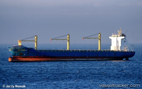
Vessel Louis S IMO: 9219381, MMSI: 304504000 Container Ship
Live AIS position:
UTC. Near Sarköy),
updated 2026-01-07 20:14:10 UTC.
Find the position of the vessel Louis S on the map. The latter are known coordinates and path.
marine traffic ship tracker show on live map
The current position of vessel Louis S is 40.54125 lat / 27.04256 lng. Updated: 2026-01-07 20:14:10 UTCCurrently sailing under the flag of Antigua Barbuda
Louis S built in 2003 year
Deadweight:
41833 tDetails:
Last coordinates of the vessel:
2026-01-07 20:14:10 UTC, 40.54125, 27.04256, course: 243, speed: 11.5