 vesseltracker.com
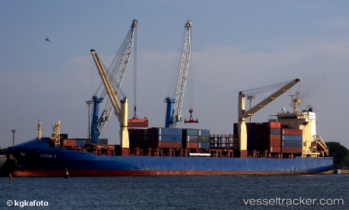
Vessel Corona J IMO: 9238686, MMSI: 304813000 Container Ship
UTC, 43.15500, -39.12667, course: -1, speed: 12
UTC, 43.27667, -38.74667, course: -1, speed: 13
2026-03-20 14:02:51 UTC, 43.47333, -38.04833, course: -1, speed: 12
Live Vessel Corona J Analytics (details, animations, etc.)
Live AIS position: UTC. 165 nm NW of Villagonzalo Pedernales), updated 2026-03-20 14:02:51 UTC.Find the position of the vessel Corona J on the map. The latter are known coordinates and path.
marine traffic ship tracker show on live map
The current position of vessel Corona J is 43.47333 lat / -38.04833 lng. Updated: 2026-03-20 14:02:51 UTCCurrently sailing under the flag of Antigua Barbuda
Corona J built in 2002 year
Deadweight:
16794 tDetails:
Last coordinates of the vessel:
UTC, 43.01315, -39.63987, course: 69, speed: 12.4UTC, 43.15500, -39.12667, course: -1, speed: 12
UTC, 43.27667, -38.74667, course: -1, speed: 13
2026-03-20 14:02:51 UTC, 43.47333, -38.04833, course: -1, speed: 12