 vesseltracker.com
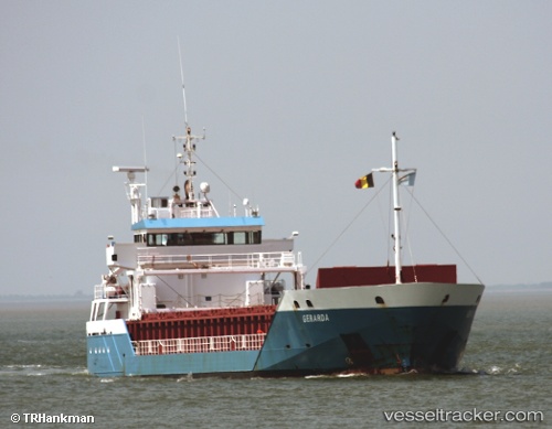
Vessel Karessa IMO: 9341770, MMSI: 305912000 Deck Cargo Ship
UTC, 53.49394, 14.61931, course: 31, speed: 0
UTC, 53.49396, 14.61934, course: 31, speed: 0
2026-02-06 07:45:50 UTC, 53.49396, 14.61930, course: 32, speed: 0
Live AIS position:
UTC. Near Skolwin),
updated 2026-02-06 07:45:50 UTC.
Find the position of the vessel Karessa on the map. The latter are known coordinates and path.
marine traffic ship tracker show on live map
The current position of vessel Karessa is 53.49396 lat / 14.61930 lng. Updated: 2026-02-06 07:45:50 UTCCurrently sailing under the flag of Antigua and Barbuda
Details:
Last coordinates of the vessel:
UTC, 53.49333, 14.61833, course: -1, speed: 0UTC, 53.49394, 14.61931, course: 31, speed: 0
UTC, 53.49396, 14.61934, course: 31, speed: 0
2026-02-06 07:45:50 UTC, 53.49396, 14.61930, course: 32, speed: 0