 vesseltracker.com
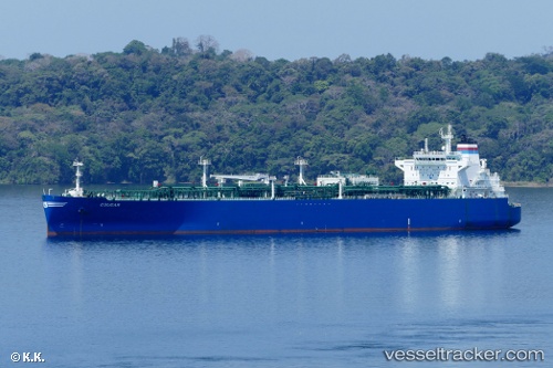
Vessel Cougar IMO: 9702003, MMSI: 311000344 Lpg Tanker
UTC, 21.76881, -168.36047, course: 118, speed: 17.3
UTC, 21.48500, -167.84167, course: -1, speed: 17
2026-02-03 00:12:08 UTC, 21.10032, -167.10820, course: 118, speed: 16.8
Live AIS position:
UTC. 296 nm NE of Johnston Island),
updated 2026-02-03 00:12:08 UTC.
Find the position of the vessel Cougar on the map. The latter are known coordinates and path.
marine traffic ship tracker show on live map
The current position of vessel Cougar is 21.10032 lat / -167.10820 lng. Updated: 2026-02-03 00:12:08 UTCCurrently sailing under the flag of Bahamas
Details:
Last coordinates of the vessel:
UTC, 21.98176, -168.75992, course: 120, speed: 17.2UTC, 21.76881, -168.36047, course: 118, speed: 17.3
UTC, 21.48500, -167.84167, course: -1, speed: 17
2026-02-03 00:12:08 UTC, 21.10032, -167.10820, course: 118, speed: 16.8