 vesseltracker.com
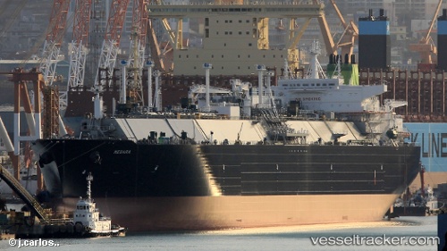
Vessel Megara IMO: 9770945, MMSI: 311000478 Lng Tanker
UTC, 41.49705, 6.81907, course: 216, speed: 16.7
UTC, 39.10067, 3.82592, course: 239, speed: 16.5
2026-02-07 04:09:46 UTC, 38.79632, 3.13510, course: 240, speed: 16.4
Live AIS position:
UTC. 38 nm S of El Palmer),
updated 2026-02-07 04:09:46 UTC.
Find the position of the vessel Megara on the map. The latter are known coordinates and path.
marine traffic ship tracker show on live map
The current position of vessel Megara is 38.79632 lat / 3.13510 lng. Updated: 2026-02-07 04:09:46 UTCDetails:
Last coordinates of the vessel:
UTC, 41.49705, 6.81907, course: 216, speed: 16.7UTC, 41.49705, 6.81907, course: 216, speed: 16.7
UTC, 39.10067, 3.82592, course: 239, speed: 16.5
2026-02-07 04:09:46 UTC, 38.79632, 3.13510, course: 240, speed: 16.4