 vesseltracker.com
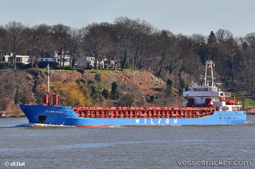
Vessel WILSON BRUGGE IMO: 9150494, MMSI: 311001763 General Cargo
UTC, 50.92188, 1.52702, course: 41, speed: 11.6
UTC, 51.20405, 1.98887, course: 51, speed: 10.9
2026-02-28 12:24:29 UTC, 51.58496, 2.39100, course: 40, speed: 9.3
Live AIS position:
UTC. 20 nm W of Thorntonbank),
updated 2026-02-28 12:24:29 UTC.
Find the position of the vessel WILSON BRUGGE on the map. The latter are known coordinates and path.
marine traffic ship tracker show on live map
The current position of vessel WILSON BRUGGE is 51.58496 lat / 2.39100 lng. Updated: 2026-02-28 12:24:29 UTCCurrently sailing under the flag of Bahamas
Details:
Last coordinates of the vessel:
UTC, 50.73582, 1.40889, course: 25, speed: 9.4UTC, 50.92188, 1.52702, course: 41, speed: 11.6
UTC, 51.20405, 1.98887, course: 51, speed: 10.9
2026-02-28 12:24:29 UTC, 51.58496, 2.39100, course: 40, speed: 9.3