 vesseltracker.com
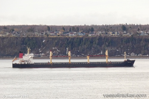
Vessel KAIA IMO: 9238325, MMSI: 314001092 Bulk Carrier
UTC, 22.76424, 69.94544, course: 101, speed: 0
UTC, 22.76415, 69.94550, course: 101, speed: 0
2026-02-27 22:13:22 UTC, 22.76423, 69.94535, course: 101, speed: 0
Live AIS position:
UTC. 13 nm SE of Mundra Port SEZ),
updated 2026-02-27 22:13:22 UTC.
Find the position of the vessel KAIA on the map. The latter are known coordinates and path.
marine traffic ship tracker show on live map
The current position of vessel KAIA is 22.76423 lat / 69.94535 lng. Updated: 2026-02-27 22:13:22 UTCCurrently sailing under the flag of Barbados
Details:
Last coordinates of the vessel:
UTC, 22.76413, 69.94543, course: 101, speed: 0UTC, 22.76424, 69.94544, course: 101, speed: 0
UTC, 22.76415, 69.94550, course: 101, speed: 0
2026-02-27 22:13:22 UTC, 22.76423, 69.94535, course: 101, speed: 0