 vesseltracker.com
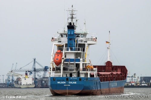
 Wilson Calais
Current Status
Where is the vessel?
Wilson Calais is currently in 36 nm E of Le Taillan-Médoc, based on AIS data received about 2h ago.
Latest AIS update:
Current position: 45.03659° N, 3.17252° W (36 nm E of Le Taillan-Médoc)
Average speed (last 7 days): Loading…
Average speed (last 30 days): Loading…
Vessel profile: Wilson Calais is a Multi Purpose Carrier with dimensions 100m x 13m.
This page combines live AIS, route history, probable destination signals, nearby traffic, and port activity for practical vessel monitoring.
The current position of vessel Wilson Calais is 45.03659 lat / -3.17252 lng. Updated: 2026-03-25 11:35:53 UTCNearest reference points:
- Near LAREDO
- 17 nm S of L'Île-d'Yeu
- Near Zierbena
Currently sailing under the flag of Barbados ![]()
Wilson Calais built in 2001 year
Deadweight:
4450 tDetails:
Live Vessel Wilson Calais Analytics (details, animations, etc.)
Recent AIS points (UTC):
2026-03-25 05:21:02 UTC · 45.85571, -3.78981 · SOG 9.1 kn · COG 150°2026-03-25 08:06:00 UTC · 45.49609, -3.51983 · SOG 8.9 kn · COG 152°
2026-03-25 09:35:51 UTC · 45.30471, -3.36513 · SOG 8.5 kn · COG 145°
2026-03-25 11:35:53 UTC · 45.03659, -3.17252 · SOG 9.3 kn · COG 149°