 vesseltracker.com
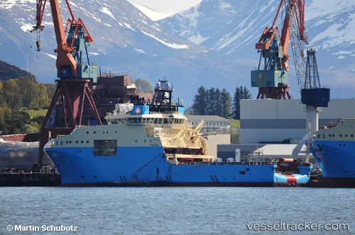
Vessel SKANDI MARINER IMO: 9761047, MMSI: 316018190 Other Type
UTC, 46.80794, -48.03394, course: 143, speed: 0.4
UTC, 46.80819, -48.03442, course: 160, speed: 0.1
2026-03-24 21:38:47 UTC, 46.80870, -48.03282, course: 189, speed: 0.3
Live Vessel SKANDI MARINER Analytics (details, animations, etc.)
Live AIS position: UTC. Near White Rose Field), updated 2026-03-24 21:38:47 UTC.Find the position of the vessel SKANDI MARINER on the map. The latter are known coordinates and path.
marine traffic ship tracker show on live map
The current position of vessel SKANDI MARINER is 46.80870 lat / -48.03282 lng. Updated: 2026-03-24 21:38:47 UTCCurrently sailing under the flag of Canada
Details:
Last coordinates of the vessel:
UTC, 46.80418, -48.03624, course: 107, speed: 0UTC, 46.80794, -48.03394, course: 143, speed: 0.4
UTC, 46.80819, -48.03442, course: 160, speed: 0.1
2026-03-24 21:38:47 UTC, 46.80870, -48.03282, course: 189, speed: 0.3