 vesseltracker.com
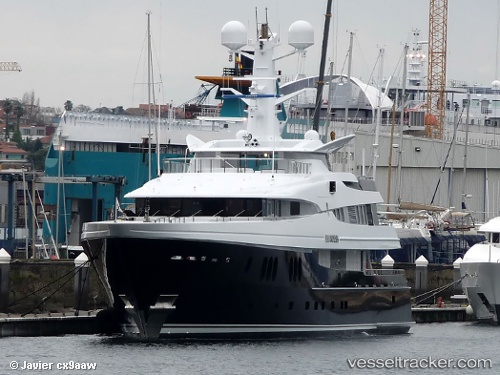
Vessel Elysian IMO: 1010179, MMSI: 319506000 Service Ship
UTC, 13.96500, -61.02167, course: -1, speed: 0
UTC, 13.96500, -61.02167, course: -1, speed: 0
2026-02-26 12:33:01 UTC, 13.93481, -61.06545, course: 206, speed: 11.5
Live AIS position:
UTC. Near CUL DESAC),
updated 2026-02-26 12:33:01 UTC.
Find the position of the vessel Elysian on the map. The latter are known coordinates and path.
marine traffic ship tracker show on live map
The current position of vessel Elysian is 13.93481 lat / -61.06545 lng. Updated: 2026-02-26 12:33:01 UTCCurrently sailing under the flag of Cayman Is
Elysian built in 2009 year
Deadweight:
217 tDetails:
Last coordinates of the vessel:
UTC, 13.96500, -61.02167, course: -1, speed: 0UTC, 13.96500, -61.02167, course: -1, speed: 0
UTC, 13.96500, -61.02167, course: -1, speed: 0
2026-02-26 12:33:01 UTC, 13.93481, -61.06545, course: 206, speed: 11.5