 vesseltracker.com
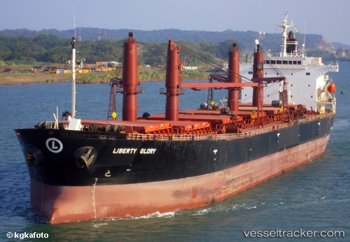
Vessel Liberty Glory IMO: 9228136, MMSI: 338217000 Bulk Carrier
UTC, -11.70167, 43.22167, course: -1, speed: 11
UTC, -11.93591, 43.04835, course: 207, speed: 15.2
2026-03-01 17:30:15 UTC, -12.36167, 42.82833, course: -1, speed: 15
Live AIS position:
UTC. 54 nm W of Mohéli Apt),
updated 2026-03-01 17:30:15 UTC.
Find the position of the vessel Liberty Glory on the map. The latter are known coordinates and path.
marine traffic ship tracker show on live map
The current position of vessel Liberty Glory is -12.36167 lat / 42.82833 lng. Updated: 2026-03-01 17:30:15 UTCCurrently sailing under the flag of USA
Liberty Glory built in 2001 year
Deadweight:
50601 tDetails:
Last coordinates of the vessel:
UTC, -11.26750, 43.28290, course: 230, speed: 15.6UTC, -11.70167, 43.22167, course: -1, speed: 11
UTC, -11.93591, 43.04835, course: 207, speed: 15.2
2026-03-01 17:30:15 UTC, -12.36167, 42.82833, course: -1, speed: 15