 vesseltracker.com
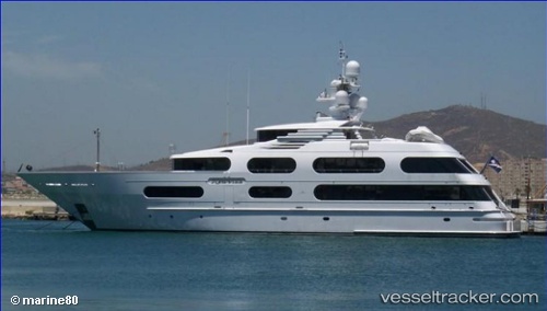
Vessel STARSHIP IMO: 9024152, MMSI: 339172000 Houseboat
UTC, 26.12200, -80.10863, course: 9, speed: 0
UTC, 26.12200, -80.10864, course: 10, speed: 0
2026-02-28 06:27:36 UTC, 26.12200, -80.10863, course: 10, speed: 0
Live AIS position:
UTC. Near Fort Lauderdale),
updated 2026-02-28 06:27:36 UTC.
Find the position of the vessel STARSHIP on the map. The latter are known coordinates and path.
marine traffic ship tracker show on live map
The current position of vessel STARSHIP is 26.12200 lat / -80.10863 lng. Updated: 2026-02-28 06:27:36 UTCCurrently sailing under the flag of Jamaica
STARSHIP built in 2001 year
Deadweight:
0 tDetails:
Last coordinates of the vessel:
UTC, 26.12200, -80.10863, course: 9, speed: 0UTC, 26.12200, -80.10863, course: 9, speed: 0
UTC, 26.12200, -80.10864, course: 10, speed: 0
2026-02-28 06:27:36 UTC, 26.12200, -80.10863, course: 10, speed: 0