 vesseltracker.com
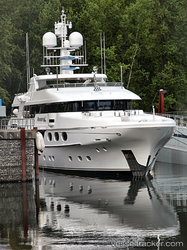
Vessel REMEMBER WHEN IMO: 9560728, MMSI: 339195000 Houseboat
UTC, 25.00403, -77.50689, course: 224, speed: 0
UTC, 25.00404, -77.50687, course: 223, speed: 0
2026-03-25 01:47:12 UTC, 25.00407, -77.50687, course: -1, speed: 0
Live Vessel REMEMBER WHEN Analytics (details, animations, etc.)
Live AIS position: UTC. Near Lyford Cay), updated 2026-03-25 01:47:12 UTC.Find the position of the vessel REMEMBER WHEN on the map. The latter are known coordinates and path.
marine traffic ship tracker show on live map
The current position of vessel REMEMBER WHEN is 25.00407 lat / -77.50687 lng. Updated: 2026-03-25 01:47:12 UTCCurrently sailing under the flag of Jamaica
REMEMBER WHEN built in 2010 year
Deadweight:
84 tDetails:
Last coordinates of the vessel:
UTC, 25.00406, -77.50687, course: 223, speed: 0UTC, 25.00403, -77.50689, course: 224, speed: 0
UTC, 25.00404, -77.50687, course: 223, speed: 0
2026-03-25 01:47:12 UTC, 25.00407, -77.50687, course: -1, speed: 0