 vesseltracker.com
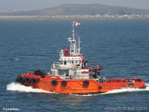
Vessel CALEU IMO: 9572795, MMSI: 345010087 Tug
UTC, 14.70752, -92.40200, course: -1, speed: 0
UTC, 14.70752, -92.40197, course: -1, speed: 0
2026-02-26 08:20:24 UTC, 14.70752, -92.40198, course: -1, speed: 0
Live AIS position:
UTC. Near PUERTO MADERO),
updated 2026-02-26 08:20:24 UTC.
Find the position of the vessel CALEU on the map. The latter are known coordinates and path.
marine traffic ship tracker show on live map
The current position of vessel CALEU is 14.70752 lat / -92.40198 lng. Updated: 2026-02-26 08:20:24 UTCCurrently sailing under the flag of Mexico
Details:
Last coordinates of the vessel:
UTC, 14.70760, -92.40197, course: -1, speed: 0UTC, 14.70752, -92.40200, course: -1, speed: 0
UTC, 14.70752, -92.40197, course: -1, speed: 0
2026-02-26 08:20:24 UTC, 14.70752, -92.40198, course: -1, speed: 0