 vesseltracker.com
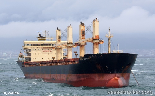
Vessel ALMA DEL MAR IMO: 9506514, MMSI: 345040010 General Cargo
UTC, 18.53167, 112.20667, course: -1, speed: 10
UTC, 18.38964, 111.63569, course: 257, speed: 9.9
2026-03-23 01:28:19 UTC, 18.32500, 111.37167, course: -1, speed: 10
Live Vessel ALMA DEL MAR Analytics (details, animations, etc.)
Live AIS position: UTC. 62 nm SE of Houan), updated 2026-03-23 01:28:19 UTC.Find the position of the vessel ALMA DEL MAR on the map. The latter are known coordinates and path.
marine traffic ship tracker show on live map
The current position of vessel ALMA DEL MAR is 18.32500 lat / 111.37167 lng. Updated: 2026-03-23 01:28:19 UTCCurrently sailing under the flag of Mexico
Details:
Last coordinates of the vessel:
UTC, 18.58667, 112.41500, course: -1, speed: 10UTC, 18.53167, 112.20667, course: -1, speed: 10
UTC, 18.38964, 111.63569, course: 257, speed: 9.9
2026-03-23 01:28:19 UTC, 18.32500, 111.37167, course: -1, speed: 10