 vesseltracker.com
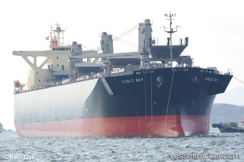
Vessel Eagle Sky IMO: 9539298, MMSI: 351010000 Wood Chips Carrier
UTC, -18.27684, -127.15532, course: 303, speed: 13
UTC, -18.13766, -127.39019, course: 303, speed: 13.1
2026-02-13 00:24:05 UTC, -17.78443, -127.97407, course: 303, speed: 13
Live AIS position:
UTC. Open sea, approx. 502 nm off the nearest listed port),
updated 2026-02-13 00:24:05 UTC.
Find the position of the vessel Eagle Sky on the map. The latter are known coordinates and path.
marine traffic ship tracker show on live map
The current position of vessel Eagle Sky is -17.78443 lat / -127.97407 lng. Updated: 2026-02-13 00:24:05 UTCDetails:
Last coordinates of the vessel:
UTC, -18.49385, -126.78673, course: 303, speed: 12.9UTC, -18.27684, -127.15532, course: 303, speed: 13
UTC, -18.13766, -127.39019, course: 303, speed: 13.1
2026-02-13 00:24:05 UTC, -17.78443, -127.97407, course: 303, speed: 13