 vesseltracker.com
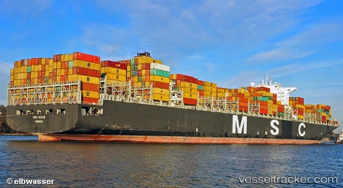
Vessel Msc Katie IMO: 9467457, MMSI: 351848000 Container Ship
UTC, 31.38828, 125.19709, course: 52, speed: 1.7
UTC, 31.35851, 125.14995, course: 48, speed: 0.9
2026-02-18 15:37:53 UTC, 31.34111, 125.14549, course: 67, speed: 0.6
Live AIS position:
UTC. 129 nm SW of Hwasun),
updated 2026-02-18 15:37:53 UTC.
Find the position of the vessel Msc Katie on the map. The latter are known coordinates and path.
marine traffic ship tracker show on live map
The current position of vessel Msc Katie is 31.34111 lat / 125.14549 lng. Updated: 2026-02-18 15:37:53 UTCCurrently sailing under the flag of Panama
Msc Katie built in 2012 year
Deadweight:
139287 tDetails:
Last coordinates of the vessel:
UTC, 31.41553, 125.21618, course: 359, speed: 1.1UTC, 31.38828, 125.19709, course: 52, speed: 1.7
UTC, 31.35851, 125.14995, course: 48, speed: 0.9
2026-02-18 15:37:53 UTC, 31.34111, 125.14549, course: 67, speed: 0.6