 vesseltracker.com
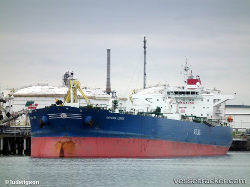
Vessel ANIKA IMO: 9417464, MMSI: 352002243 Crude Oil Tanker
UTC, 7.71743, 73.51521, course: 292, speed: 13.9
UTC, 8.00300, 72.72837, course: 292, speed: 14.2
2026-03-24 12:01:11 UTC, 8.14298, 72.32335, course: 289, speed: 14.7
Live Vessel ANIKA Analytics (details, animations, etc.)
Live AIS position: UTC. 101 nm NW of Kulhudhuffushi), updated 2026-03-24 12:01:11 UTC.Find the position of the vessel ANIKA on the map. The latter are known coordinates and path.
marine traffic ship tracker show on live map
The current position of vessel ANIKA is 8.14298 lat / 72.32335 lng. Updated: 2026-03-24 12:01:11 UTCCurrently sailing under the flag of Panama
Details:
Last coordinates of the vessel:
UTC, 7.62417, 73.78762, course: 293, speed: 13.7UTC, 7.71743, 73.51521, course: 292, speed: 13.9
UTC, 8.00300, 72.72837, course: 292, speed: 14.2
2026-03-24 12:01:11 UTC, 8.14298, 72.32335, course: 289, speed: 14.7