 vesseltracker.com
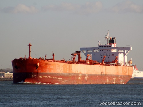
Vessel VOLTA RIVER IMO: 9336414, MMSI: 352002521 Crude Oil Tanker
UTC, 12.35272, 44.03452, course: 289, speed: 13.4
UTC, 12.50957, 43.62109, course: 290, speed: 14.4
2026-01-18 07:30:41 UTC, 12.92532, 43.21764, course: 332, speed: 17.3
Live AIS position:
UTC. 20 nm NW of Perim Island),
updated 2026-01-18 07:30:41 UTC.
Find the position of the vessel VOLTA RIVER on the map. The latter are known coordinates and path.
marine traffic ship tracker show on live map
The current position of vessel VOLTA RIVER is 12.92532 lat / 43.21764 lng. Updated: 2026-01-18 07:30:41 UTCCurrently sailing under the flag of Panama
VOLTA RIVER built in 2007 year
Deadweight:
105839 tDetails:
Last coordinates of the vessel:
UTC, 12.27384, 44.24844, course: 289, speed: 13.4UTC, 12.35272, 44.03452, course: 289, speed: 13.4
UTC, 12.50957, 43.62109, course: 290, speed: 14.4
2026-01-18 07:30:41 UTC, 12.92532, 43.21764, course: 332, speed: 17.3