 vesseltracker.com
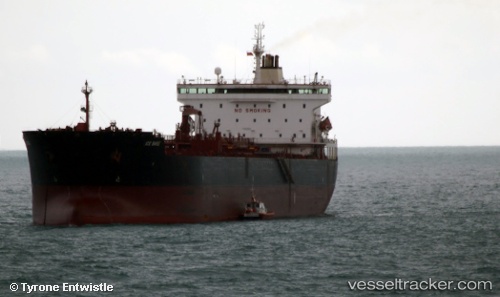
Vessel CABO SAN VICENTE IMO: 9346433, MMSI: 352002603 Oil Products Tanker
UTC, -30.97143, -72.39677, course: 164, speed: 12.9
UTC, -31.34006, -72.25621, course: 165, speed: 13.1
2026-03-21 18:00:04 UTC, -31.87460, -72.03204, course: 161, speed: 12.9
Live Vessel CABO SAN VICENTE Analytics (details, animations, etc.)
Live AIS position: UTC. 27 nm W of Punta Chungo), updated 2026-03-21 18:00:04 UTC.Find the position of the vessel CABO SAN VICENTE on the map. The latter are known coordinates and path.
marine traffic ship tracker show on live map
The current position of vessel CABO SAN VICENTE is -31.87460 lat / -72.03204 lng. Updated: 2026-03-21 18:00:04 UTCCurrently sailing under the flag of Panama
Details:
Last coordinates of the vessel:
UTC, -30.50350, -72.54172, course: 172, speed: 12.7UTC, -30.97143, -72.39677, course: 164, speed: 12.9
UTC, -31.34006, -72.25621, course: 165, speed: 13.1
2026-03-21 18:00:04 UTC, -31.87460, -72.03204, course: 161, speed: 12.9