 vesseltracker.com
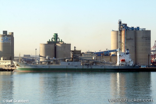
Vessel JUI HO IMO: 9194816, MMSI: 352004467 Cement Carrier
UTC, 24.28757, 120.53170, course: -1, speed: 0
UTC, 24.28742, 120.53167, course: -1, speed: 0
2026-03-02 03:24:41 UTC, 24.28773, 120.53167, course: -1, speed: 0.1
Live AIS position:
UTC. Near Tai-tung Kang),
updated 2026-03-02 03:24:41 UTC.
Find the position of the vessel JUI HO on the map. The latter are known coordinates and path.
marine traffic ship tracker show on live map
The current position of vessel JUI HO is 24.28773 lat / 120.53167 lng. Updated: 2026-03-02 03:24:41 UTCCurrently sailing under the flag of Panama
Details:
Last coordinates of the vessel:
UTC, 24.28747, 120.53170, course: -1, speed: 0UTC, 24.28757, 120.53170, course: -1, speed: 0
UTC, 24.28742, 120.53167, course: -1, speed: 0
2026-03-02 03:24:41 UTC, 24.28773, 120.53167, course: -1, speed: 0.1