 vesseltracker.com
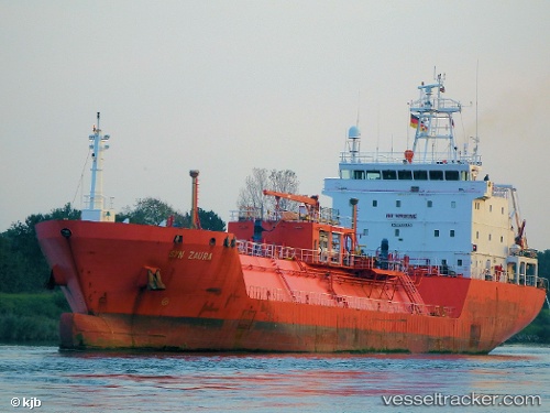
Vessel MONA IMO: 9187837, MMSI: 352004984 Lpg Tanker
UTC, 40.76476, 29.73254, course: 254, speed: 0
UTC, 40.76480, 29.73253, course: 252, speed: 0
2026-03-10 17:47:07 UTC, 40.76478, 29.73250, course: 252, speed: 0
Live Vessel MONA Analytics (details, animations, etc.)
Live AIS position: UTC. Near YARIMCA), updated 2026-03-10 17:47:07 UTC.Find the position of the vessel MONA on the map. The latter are known coordinates and path.
marine traffic ship tracker show on live map
The current position of vessel MONA is 40.76478 lat / 29.73250 lng. Updated: 2026-03-10 17:47:07 UTCCurrently sailing under the flag of Panama
Details:
Last coordinates of the vessel:
UTC, 40.76481, 29.73253, course: 250, speed: 0UTC, 40.76476, 29.73254, course: 254, speed: 0
UTC, 40.76480, 29.73253, course: 252, speed: 0
2026-03-10 17:47:07 UTC, 40.76478, 29.73250, course: 252, speed: 0