 vesseltracker.com
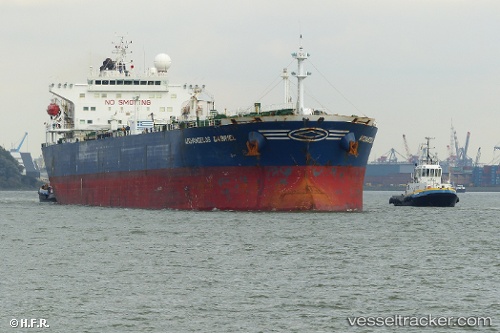
Vessel BANGUS IMO: 9308998, MMSI: 352005365 Oil Products Tanker
UTC, 3.63436, 105.10461, course: 247, speed: 0
UTC, 3.63347, 105.10678, course: 336, speed: 0.2
2026-02-28 17:32:01 UTC, 3.63320, 105.10363, course: 193, speed: 0.2
Live AIS position:
UTC. 30 nm S of Belida Terminal),
updated 2026-02-28 17:32:01 UTC.
Find the position of the vessel BANGUS on the map. The latter are known coordinates and path.
marine traffic ship tracker show on live map
The current position of vessel BANGUS is 3.63320 lat / 105.10363 lng. Updated: 2026-02-28 17:32:01 UTCCurrently sailing under the flag of Panama
Details:
Last coordinates of the vessel:
UTC, 3.63362, 105.10671, course: 330, speed: 0.2UTC, 3.63436, 105.10461, course: 247, speed: 0
UTC, 3.63347, 105.10678, course: 336, speed: 0.2
2026-02-28 17:32:01 UTC, 3.63320, 105.10363, course: 193, speed: 0.2