 vesseltracker.com
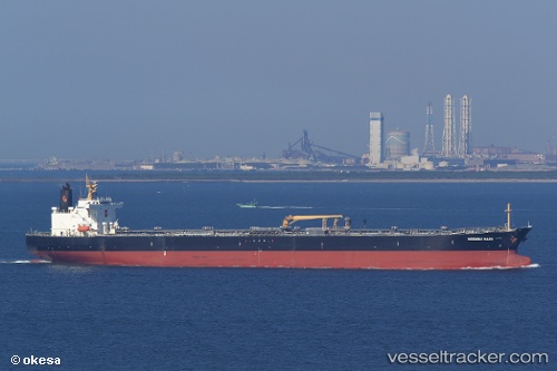
Vessel AMARIN INDAH IMO: 9299941, MMSI: 352005852 Crude Oil Tanker
UTC, 27.09013, 34.48826, course: 321, speed: 12.8
UTC, 27.49383, 34.16608, course: 324, speed: 12.4
2026-03-24 21:52:19 UTC, 27.79633, 33.79536, course: 317, speed: 13
Live Vessel AMARIN INDAH Analytics (details, animations, etc.)
Live AIS position: UTC. 10 nm E of Zeit Bay), updated 2026-03-24 21:52:19 UTC.Find the position of the vessel AMARIN INDAH on the map. The latter are known coordinates and path.
marine traffic ship tracker show on live map
The current position of vessel AMARIN INDAH is 27.79633 lat / 33.79536 lng. Updated: 2026-03-24 21:52:19 UTCCurrently sailing under the flag of Panama
Details:
Last coordinates of the vessel:
UTC, 26.90806, 34.63802, course: 321, speed: 12.4UTC, 27.09013, 34.48826, course: 321, speed: 12.8
UTC, 27.49383, 34.16608, course: 324, speed: 12.4
2026-03-24 21:52:19 UTC, 27.79633, 33.79536, course: 317, speed: 13