 vesseltracker.com
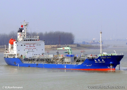
Vessel ROAMA 8 IMO: 9258832, MMSI: 352005898 Oil/Chemical Tanker
UTC, 25.26702, 119.95479, course: 200, speed: 10.5
UTC, 25.05390, 119.77170, course: 230, speed: 10.7
2026-03-14 07:28:40 UTC, 24.87032, 119.54436, course: 228, speed: 11.1
Live Vessel ROAMA 8 Analytics (details, animations, etc.)
Live AIS position: UTC. 19 nm S of Damaiyu), updated 2026-03-14 07:28:40 UTC.Find the position of the vessel ROAMA 8 on the map. The latter are known coordinates and path.
marine traffic ship tracker show on live map
The current position of vessel ROAMA 8 is 24.87032 lat / 119.54436 lng. Updated: 2026-03-14 07:28:40 UTCCurrently sailing under the flag of Panama
Details:
Last coordinates of the vessel:
UTC, 25.53034, 120.20064, course: 247, speed: 10.7UTC, 25.26702, 119.95479, course: 200, speed: 10.5
UTC, 25.05390, 119.77170, course: 230, speed: 10.7
2026-03-14 07:28:40 UTC, 24.87032, 119.54436, course: 228, speed: 11.1