 vesseltracker.com
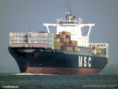
Vessel Msc Loretta IMO: 9230490, MMSI: 352140000 Container Ship
UTC, 40.41779, 29.10993, course: 81, speed: 0
UTC, 40.41779, 29.10994, course: 82, speed: 0
2026-02-17 22:10:05 UTC, 40.41774, 29.10997, course: 82, speed: 0
Live AIS position:
UTC. Near GEMLIK),
updated 2026-02-17 22:10:05 UTC.
Find the position of the vessel Msc Loretta on the map. The latter are known coordinates and path.
marine traffic ship tracker show on live map
The current position of vessel Msc Loretta is 40.41774 lat / 29.10997 lng. Updated: 2026-02-17 22:10:05 UTCDetails:
Last coordinates of the vessel:
UTC, 40.41774, 29.10999, course: 82, speed: 0UTC, 40.41779, 29.10993, course: 81, speed: 0
UTC, 40.41779, 29.10994, course: 82, speed: 0
2026-02-17 22:10:05 UTC, 40.41774, 29.10997, course: 82, speed: 0