 vesseltracker.com
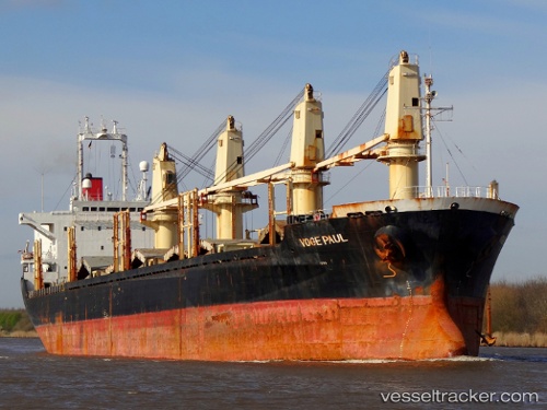
Vessel Best Will IMO: 9154866, MMSI: 352373000 Bulk Carrier
UTC, 14.78489, 53.65014, course: -1, speed: 7.6
UTC, 14.96333, 53.95500, course: -1, speed: 8
2026-02-13 15:12:26 UTC, 15.03174, 54.07080, course: -1, speed: 7.9
Live AIS position:
UTC. 115 nm S of Port Raysut),
updated 2026-02-13 15:12:26 UTC.
Find the position of the vessel Best Will on the map. The latter are known coordinates and path.
marine traffic ship tracker show on live map
The current position of vessel Best Will is 15.03174 lat / 54.07080 lng. Updated: 2026-02-13 15:12:26 UTCDetails:
Last coordinates of the vessel:
UTC, 14.63176, 53.39171, course: -1, speed: 7.5UTC, 14.78489, 53.65014, course: -1, speed: 7.6
UTC, 14.96333, 53.95500, course: -1, speed: 8
2026-02-13 15:12:26 UTC, 15.03174, 54.07080, course: -1, speed: 7.9