 vesseltracker.com
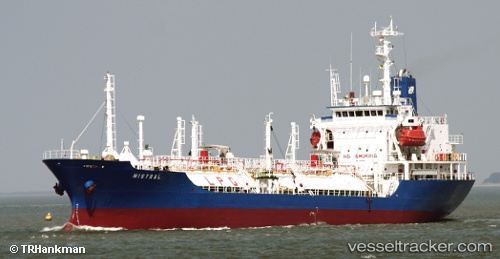
Vessel '352978176' IMO: 9045651, MMSI: 352978176
UTC, 40.95169, 28.87841, course: 208, speed: 0
UTC, 40.95121, 28.87894, course: 252, speed: 0.1
2026-02-21 06:33:27 UTC, 40.94980, 28.87748, course: 21, speed: 0
Live AIS position:
UTC. Near BAKIRKOY),
updated 2026-02-21 06:33:27 UTC.
Find the position of the vessel '352978176' on the map. The latter are known coordinates and path.
marine traffic ship tracker show on live map
The current position of vessel '352978176' is 40.94980 lat / 28.87748 lng. Updated: 2026-02-21 06:33:27 UTCDetails:
Last coordinates of the vessel:
UTC, 40.95177, 28.87759, course: 166, speed: 0UTC, 40.95169, 28.87841, course: 208, speed: 0
UTC, 40.95121, 28.87894, course: 252, speed: 0.1
2026-02-21 06:33:27 UTC, 40.94980, 28.87748, course: 21, speed: 0