 vesseltracker.com
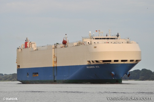
Vessel Progress Ace IMO: 9267687, MMSI: 353514000 Vehicles Carrier
UTC, 34.56168, 135.25487, course: 45, speed: 17.2
UTC, 34.68287, 135.29060, course: 176, speed: 0.4
2026-02-13 23:42:37 UTC, 34.68276, 135.29044, course: 172, speed: 0
Live AIS position:
UTC. Near Nada-Ku, Hyogo),
updated 2026-02-13 23:42:37 UTC.
Find the position of the vessel Progress Ace on the map. The latter are known coordinates and path.
marine traffic ship tracker show on live map
The current position of vessel Progress Ace is 34.68276 lat / 135.29044 lng. Updated: 2026-02-13 23:42:37 UTCDetails:
Last coordinates of the vessel:
UTC, 34.09095, 134.98248, course: 0, speed: 9.8UTC, 34.56168, 135.25487, course: 45, speed: 17.2
UTC, 34.68287, 135.29060, course: 176, speed: 0.4
2026-02-13 23:42:37 UTC, 34.68276, 135.29044, course: 172, speed: 0