 vesseltracker.com
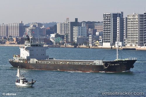
Vessel Star Gate IMO: 9033373, MMSI: 353653000 Limestone Carrier
UTC, 35.67668, 139.97331, course: 282, speed: 0
UTC, 35.67668, 139.97334, course: 282, speed: 0
2026-03-20 13:57:18 UTC, 35.67667, 139.97334, course: 282, speed: 0
Live Vessel Star Gate Analytics (details, animations, etc.)
Live AIS position: UTC. Near Narashino), updated 2026-03-20 13:57:18 UTC.Find the position of the vessel Star Gate on the map. The latter are known coordinates and path.
marine traffic ship tracker show on live map
The current position of vessel Star Gate is 35.67667 lat / 139.97334 lng. Updated: 2026-03-20 13:57:18 UTCCurrently sailing under the flag of Panama
Star Gate built in 1991 year
Deadweight:
3488 tDetails:
Last coordinates of the vessel:
UTC, 35.67670, 139.97331, course: 282, speed: 0UTC, 35.67668, 139.97331, course: 282, speed: 0
UTC, 35.67668, 139.97334, course: 282, speed: 0
2026-03-20 13:57:18 UTC, 35.67667, 139.97334, course: 282, speed: 0