 vesseltracker.com
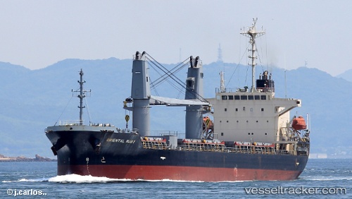
Vessel JC RUBY IMO: 9255256, MMSI: 354964000 Bulk Carrier
UTC, 45.13993, 29.88585, course: 325, speed: 10
UTC, 45.13993, 29.88585, course: 325, speed: 10
2026-01-14 16:52:57 UTC, 45.13993, 29.88585, course: 325, speed: 10
Live AIS position:
UTC. Near Sulina (Port et Zone Franche)),
updated 2026-01-14 16:52:57 UTC.
Find the position of the vessel JC RUBY on the map. The latter are known coordinates and path.
marine traffic ship tracker show on live map
The current position of vessel JC RUBY is 45.13993 lat / 29.88585 lng. Updated: 2026-01-14 16:52:57 UTCCurrently sailing under the flag of Panama
JC RUBY built in 2002 year
Deadweight:
16732 tDetails:
Last coordinates of the vessel:
UTC, 45.06118, 29.97475, course: 314, speed: 10UTC, 45.13993, 29.88585, course: 325, speed: 10
UTC, 45.13993, 29.88585, course: 325, speed: 10
2026-01-14 16:52:57 UTC, 45.13993, 29.88585, course: 325, speed: 10