 vesseltracker.com
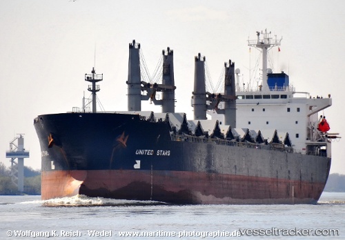
 Vera P
Current Status
Where is the vessel?
Vera P is currently in Near EL DEKHEILA, based on AIS data received about 2h ago.
Latest AIS update:
Current position: 31.24817° N, 29.70706° E (Near EL DEKHEILA)
Average speed (last 7 days): Loading…
Average speed (last 30 days): Loading…
Vessel profile: Vera P is a Bulk Carrier with dimensions 190m x 31m.
This page combines live AIS, route history, probable destination signals, nearby traffic, and port activity for practical vessel monitoring.
The current position of vessel Vera P is 31.24817 lat / 29.70706 lng. Updated: 2026-03-25 15:43:29 UTCNearest reference points:
- Near EL DEKHEILA
- Near Alexandria
- 13 nm W of EL DEKHEILA
Currently sailing under the flag of Panama ![]()
Vera P built in 1995 year
Deadweight:
43991 tDetails:
Live Vessel Vera P Analytics (details, animations, etc.)
Recent AIS points (UTC):
2026-03-25 09:53:07 UTC · 31.24871, 29.70685 · SOG 0 kn · COG -1°2026-03-25 12:20:59 UTC · 31.24825, 29.70698 · SOG 0 kn · COG -1°
2026-03-25 13:43:32 UTC · 31.24806, 29.70694 · SOG 0.1 kn · COG -1°
2026-03-25 15:43:29 UTC · 31.24817, 29.70706 · SOG 0.1 kn · COG 293°