 vesseltracker.com
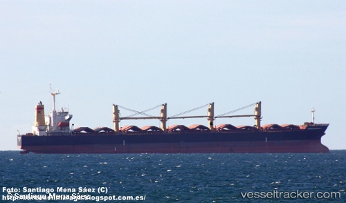
Vessel KAI YUE IMO: 9181041, MMSI: 355300000 Bulk Carrier
UTC, 11.71700, 73.98726, course: -1, speed: 11.5
UTC, 11.72923, 73.97930, course: -1, speed: 11.5
2026-02-27 02:16:34 UTC, 12.40212, 73.54936, course: 329, speed: 12
Live AIS position:
UTC. 76 nm W of New Mangalore),
updated 2026-02-27 02:16:34 UTC.
Find the position of the vessel KAI YUE on the map. The latter are known coordinates and path.
marine traffic ship tracker show on live map
The current position of vessel KAI YUE is 12.40212 lat / 73.54936 lng. Updated: 2026-02-27 02:16:34 UTCCurrently sailing under the flag of Panama
KAI YUE built in 2000 year
Deadweight:
50326 tDetails:
Last coordinates of the vessel:
UTC, 11.25506, 74.27782, course: 328, speed: 11.8UTC, 11.71700, 73.98726, course: -1, speed: 11.5
UTC, 11.72923, 73.97930, course: -1, speed: 11.5
2026-02-27 02:16:34 UTC, 12.40212, 73.54936, course: 329, speed: 12