 vesseltracker.com
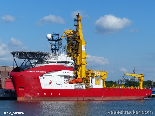
Vessel SAPURA DIAMANTE IMO: 9656187, MMSI: 355422000 Pipe Layer
UTC, -21.87290, -40.61498, course: 272, speed: 8.9
UTC, -21.82828, -40.92431, course: 278, speed: 10.6
2026-02-27 12:19:37 UTC, -21.85550, -41.01202, course: 330, speed: 0
Live AIS position:
UTC. Near PORTO DO ACU),
updated 2026-02-27 12:19:37 UTC.
Find the position of the vessel SAPURA DIAMANTE on the map. The latter are known coordinates and path.
marine traffic ship tracker show on live map
The current position of vessel SAPURA DIAMANTE is -21.85550 lat / -41.01202 lng. Updated: 2026-02-27 12:19:37 UTCCurrently sailing under the flag of Panama
Details:
Last coordinates of the vessel:
UTC, -21.89378, -40.39375, course: 275, speed: 8.8UTC, -21.87290, -40.61498, course: 272, speed: 8.9
UTC, -21.82828, -40.92431, course: 278, speed: 10.6
2026-02-27 12:19:37 UTC, -21.85550, -41.01202, course: 330, speed: 0