 vesseltracker.com
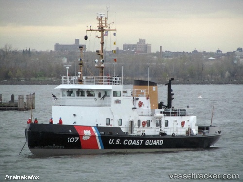
Vessel Cg Penobscot Bay IMO: 8635186, MMSI: 366999982 Tug
UTC, 40.67207, -74.08804, course: -1, speed: 0
UTC, 40.67203, -74.08803, course: 291, speed: 0.2
2026-03-24 11:28:43 UTC, 40.67203, -74.08803, course: 291, speed: 0.1
Live Vessel Cg Penobscot Bay Analytics (details, animations, etc.)
Live AIS position: UTC. Near Port Newark), updated 2026-03-24 11:28:43 UTC.Find the position of the vessel Cg Penobscot Bay on the map. The latter are known coordinates and path.
marine traffic ship tracker show on live map
The current position of vessel Cg Penobscot Bay is 40.67203 lat / -74.08803 lng. Updated: 2026-03-24 11:28:43 UTCCurrently sailing under the flag of USA
Details:
Last coordinates of the vessel:
UTC, 40.67206, -74.08801, course: -1, speed: 0UTC, 40.67207, -74.08804, course: -1, speed: 0
UTC, 40.67203, -74.08803, course: 291, speed: 0.2
2026-03-24 11:28:43 UTC, 40.67203, -74.08803, course: 291, speed: 0.1