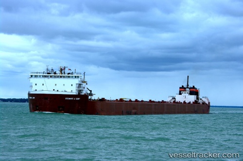
 Stewart J Cort
Current Status
Where is the vessel?
Stewart J Cort is currently in Near Burns Harbor, based on AIS data received about 15h ago.
Latest AIS update:
Current position: 41.63641° N, 87.14765° W (Near Burns Harbor)
Average speed (last 7 days): Loading…
Average speed (last 30 days): Loading…
Vessel profile: Stewart J Cort is a Self Discharging Bulk Carrier with dimensions 305m x 32m.
This page combines live AIS, route history, probable destination signals, nearby traffic, and port activity for practical vessel monitoring.
The current position of vessel Stewart J Cort is 41.63641 lat / -87.14765 lng. Updated: 2026-05-24 03:30:00 UTCNearest reference points:
- Near Burns Harbor
- Near Burnham
- Near WAUKEGAN
Currently sailing under the flag of USA ![]()
Stewart J Cort built in 1971 year
Deadweight:
60079 tDetails:
Live Vessel Stewart J Cort Analytics (details, animations, etc.)
Recent AIS points (UTC):
2026-05-23 23:20:56 UTC · 41.63641, -87.14764 · SOG 0 kn · COG 180°2026-05-24 01:53:52 UTC · 41.63641, -87.14764 · SOG 0 kn · COG 180°
2026-05-24 01:53:52 UTC · 41.63641, -87.14764 · SOG 0 kn · COG 180°
2026-05-24 03:30:00 UTC · 41.63641, -87.14765 · SOG 0 kn · COG 179°