 vesseltracker.com
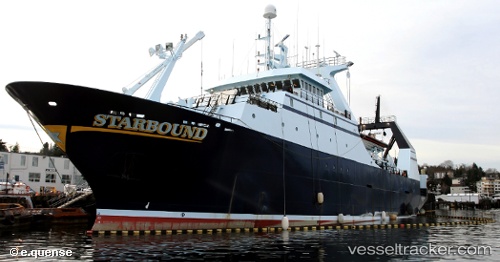
Vessel Starbound IMO: 8807284, MMSI: 367161000 Fishing Vessel
UTC, 53.84263, -166.58363, course: 348, speed: 0
UTC, 53.84262, -166.58365, course: 348, speed: 0
2026-01-20 04:00:05 UTC, 53.84263, -166.58363, course: 349, speed: 0
Live AIS position:
UTC. Near Dutch Harbor),
updated 2026-01-20 04:00:05 UTC.
Find the position of the vessel Starbound on the map. The latter are known coordinates and path.
marine traffic ship tracker show on live map
The current position of vessel Starbound is 53.84263 lat / -166.58363 lng. Updated: 2026-01-20 04:00:05 UTCCurrently sailing under the flag of USA
Details:
Last coordinates of the vessel:
UTC, 53.84262, -166.58360, course: 348, speed: 0UTC, 53.84263, -166.58363, course: 348, speed: 0
UTC, 53.84262, -166.58365, course: 348, speed: 0
2026-01-20 04:00:05 UTC, 53.84263, -166.58363, course: 349, speed: 0