 vesseltracker.com
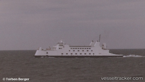
Vessel Pt Barnum IMO: 8654285, MMSI: 367400420 Passenger Ro Ro Cargo Ship
UTC, 41.10565, -73.17303, course: -1, speed: 16.3
UTC, 41.05980, -73.13213, course: -1, speed: 16.6
2026-02-15 19:56:14 UTC, 40.94793, -73.06976, course: -1, speed: 0
Live AIS position:
UTC. Near Port Jefferson),
updated 2026-02-15 19:56:14 UTC.
Find the position of the vessel Pt Barnum on the map. The latter are known coordinates and path.
marine traffic ship tracker show on live map
The current position of vessel Pt Barnum is 40.94793 lat / -73.06976 lng. Updated: 2026-02-15 19:56:14 UTCDetails:
Last coordinates of the vessel:
UTC, 41.02294, -73.12252, course: -1, speed: 16.6UTC, 41.10565, -73.17303, course: -1, speed: 16.3
UTC, 41.05980, -73.13213, course: -1, speed: 16.6
2026-02-15 19:56:14 UTC, 40.94793, -73.06976, course: -1, speed: 0